At Veracity Civil Solutions, we provide accurate and constructible underground utility plans for residential, commercial, and industrial developments across the United States. Our plans are prepared with real-world construction logic, local approval requirements, and contractor coordination in mind—not generic layouts.
Whether you’re in early planning, budgeting, or moving toward permitting, our underground utility plans help ensure utilities are routed efficiently, conflicts are minimized, and the site is ready for construction.
Our underground utility planning services are designed to support conceptual planning, budgeting, coordination, and future permitting efforts. The scope is customized for each project, but typically includes:
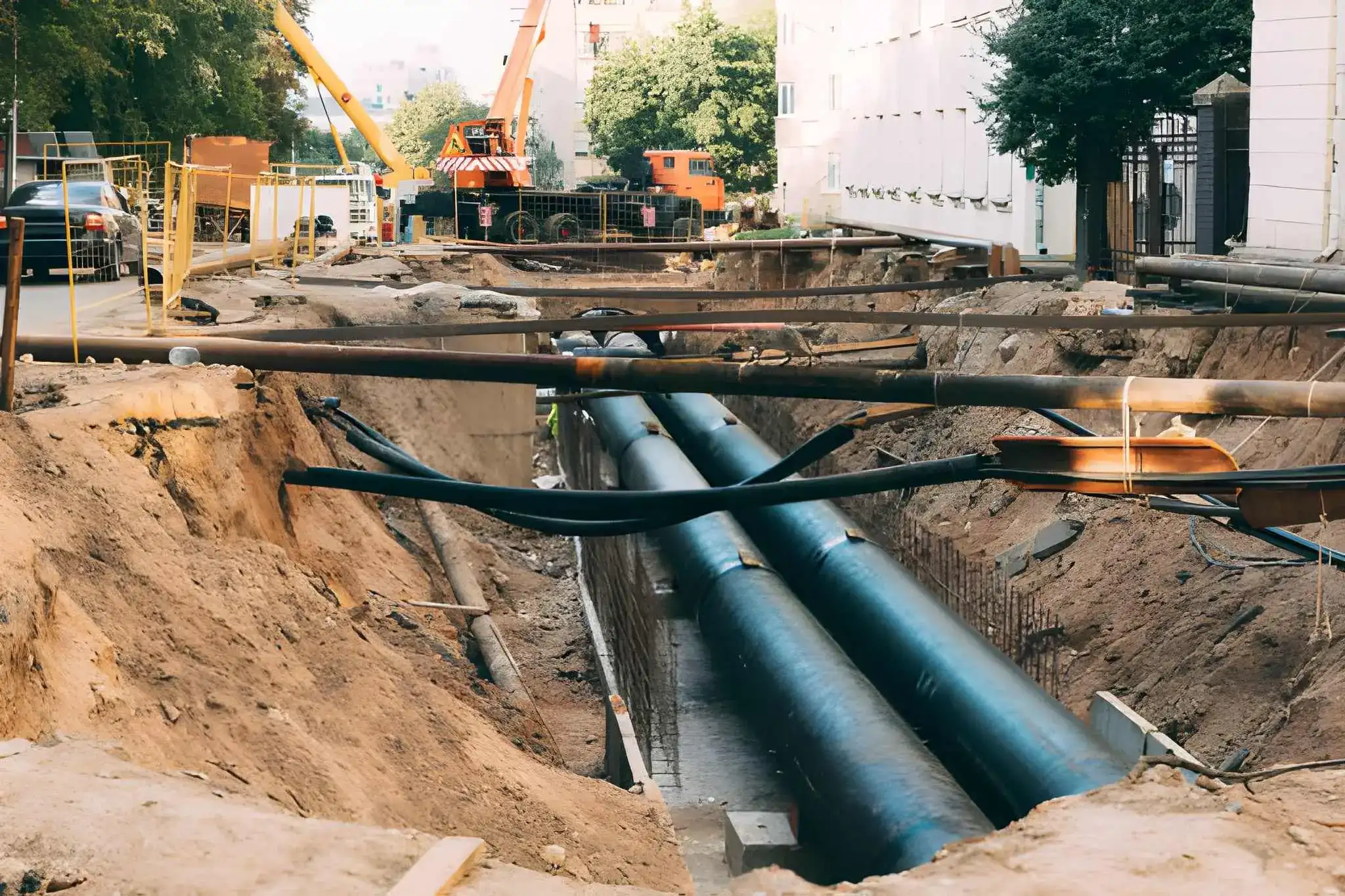
We prepare clear water utility layouts showing service connections, main routing, and fire line coordination where required. Plans are developed to align with site grading, access, and constructability needs.
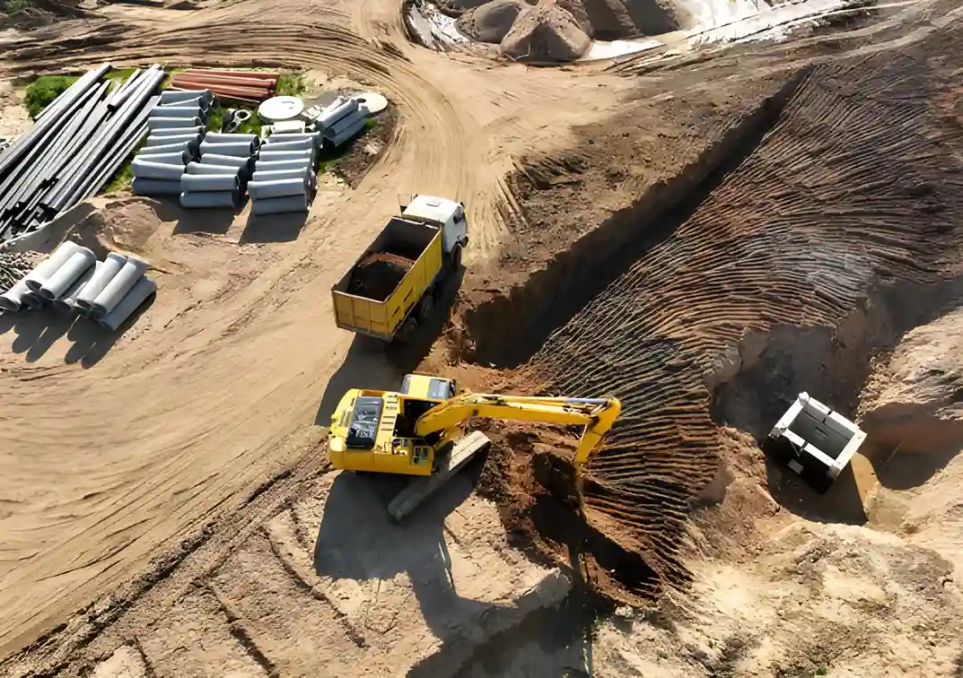
Our sanitary sewer plans include preliminary routing, slopes, and connection points based on site constraints and available data. Layouts are prepared to support budgeting, coordination, and future permitting.
We develop storm utility layouts that integrate with grading and drainage concepts, including pipe runs and structure locations. Designs focus on practical flow paths and coordination with surface drainage.
For every underground utility planning project, we provide clear, well-organized deliverables designed for easy review, coordination, and construction planning.

To deliver accurate and coordinated civil engineering plans, we require specific project information from our clients. Providing complete and correct files helps reduce revisions and speeds up delivery.
Below is a list of commonly required files (if available). Requirements may vary depending on project scope and location.
Note on Surveys and Alternate Data Sources:
If a topographic survey is not available, we can prepare plans using available GIS data. Please note that GIS based work is less detailed than a licensed survey and may involve additional charges.
If neither a proposed site plan nor a topographic survey is provided, the client must supply a boundary survey or recorded plat. Additional coordination or data processing fees may apply in such cases.
Providing accurate survey information helps ensure better results, fewer revisions, and faster delivery.
We delivers precise underground utility plans fully integrated with civil design drafting for projects nationwide. We ensure utilities, grading, and site development are accurately coordinated, helping clients avoid conflicts, meet local regulations, and streamline construction—whether in urban centers or rural locations.
Our project portfolio reflects hands-on experience preparing underground utility plans for residential, commercial, and light industrial developments across the United States. We’ve worked on water, sanitary sewer, storm drainage, fire lines, and utility coordination for projects at both conceptual and permit-ready stages.

Expertise You Can Trust – Our experienced team specializes in creating accurate underground utility plans, fully coordinated with our civil engineering designs to ensure seamless project execution.
Integrated Civil & Utility Solutions – We collaborate closely with our civil engineering team to align grading, drainage, and sitework plans with underground utilities, minimizing conflicts and rework.
Comprehensive Coverage – From water, sewer, and storm lines to electrical, gas, and communication systems, we provide detailed plans that cover all aspects of your project site.
Time-Saving Solutions – Our streamlined workflow allows us to deliver high-quality plans quickly, keeping your project on schedule while ensuring precision.
Advanced Technology – Using the latest CAD, GIS, and 3D modeling tools, we create clear, clash-free plans that prevent costly surprises during construction.
We serve construction companies, civil engineering firms, architects, developers, municipalities, and utility providers, delivering precise underground utility and site plans that are fully coordinated with civil engineering designs to ensure safe, efficient, and cost-effective project execution.
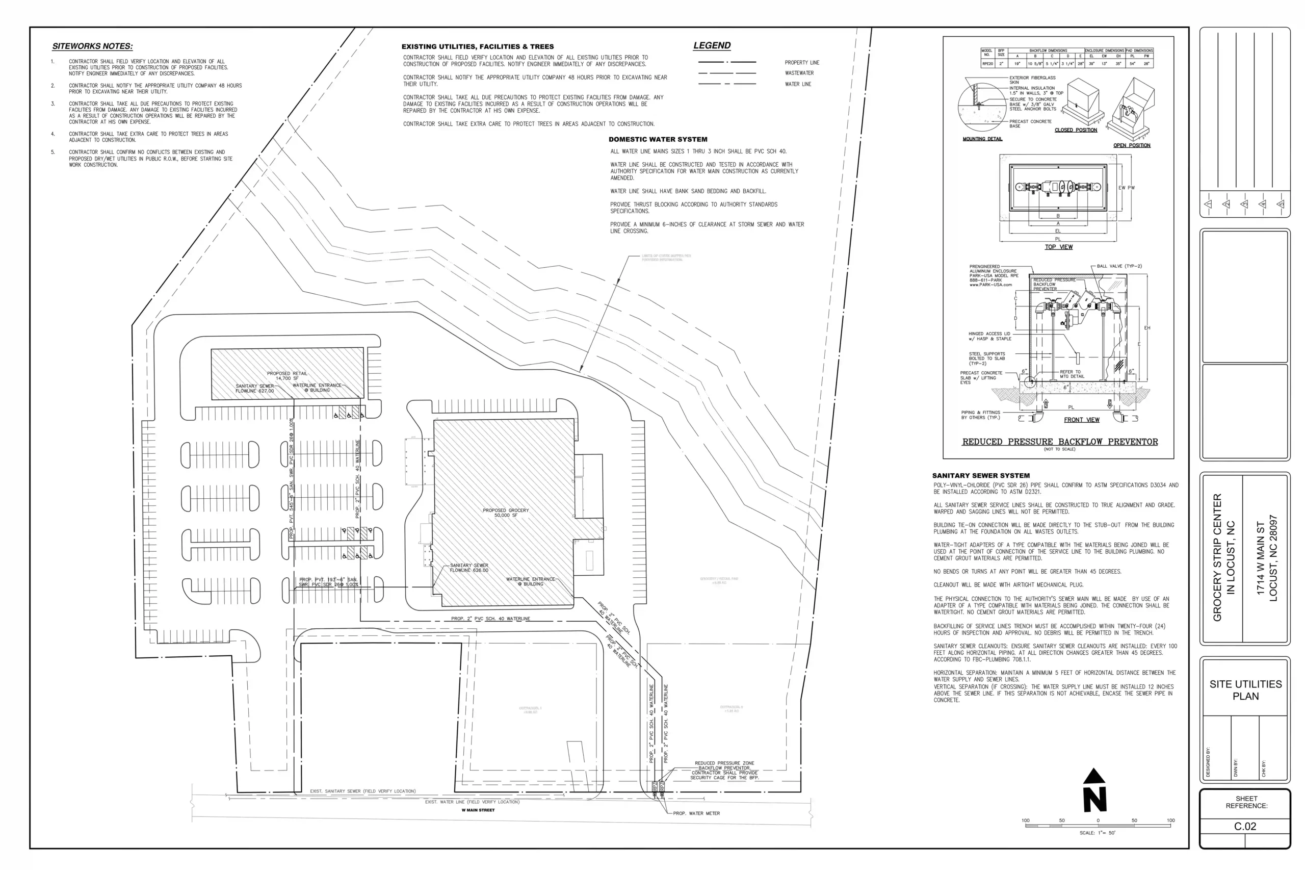
An underground utility plan is a detailed drawing that shows the location and layout of a single project’s utilities beneath the ground, including water, sewer, electrical, gas, and communication lines. It guides construction, prevents conflicts, and ensures safety.
An accurate plan prevents costly errors, reduces project delays, and avoids damage to existing utilities. It ensures construction work is safe, compliant with regulations, and coordinated with civil and structural design.
An underground utility plan uses symbols, color codes, and line types to represent different utilities. The legend explains these symbols, while the scale and notes provide additional details about depth, material, and routing.
A contractor, civil engineer, architect, developer, municipality, or utility provider can use an underground utility plan to ensure safe and efficient project execution.
A plan typically shows the type, size, and location of each utility, existing and proposed lines, easements, service connections, and civil design elements like grading and drainage.
It is coordinated with grading, drainage, road layout, and site development plans to avoid conflicts and ensure smooth construction sequencing.

At Veracity Civil Solutions, we provide expert civil design drafting to clients across the United States. We delivers precise, compliant and fully coordinated plans that meet local regulations and regional standards.
We support projects in all U.S. states, including major regions such as:
California, Texas, Florida, New York, Illinois, Pennsylvania, Ohio, Georgia, North Carolina, Michigan, New Jersey, Virginia, Washington, Arizona, Massachusetts, Tennessee, Indiana, Missouri, Maryland, Wisconsin, Colorado, Minnesota, South Carolina, Alabama, Kentucky, Oregon, Oklahoma, Connecticut, Iowa, and Nevada.
Our services cover urban, suburban, and rural locations, supporting residential, commercial, and mixed-use developments. We have extensive experience navigating local permitting processes, zoning requirements, and municipal review standards, allowing us to provide consistent, high-quality deliverables no matter where your project is located.
Whether your project is in a major city or a smaller municipality, we bring the same level of technical expertise, coordination, and attention to detail to ensure your project stays on schedule and meets all regulatory and design requirements.